Armstrong County
Texas Trails To The Past
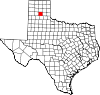 Armstrong County, in the central Panhandle
on the eastern edge of the Texas High Plains, is bounded on the east by
Donley County, on the north by Carson County, on the west by Randall
County, and on the south by Swisher and Briscoe counties. It is named
for one of several pioneer Texas families named Armstrong, though the
sources are unclear about which one. The center of the county lies
approximately at 34°58' north latitude and 101°20' west longitude.
Claude, the county seat, is in the north central part of the county
thirty miles east of Amarillo. Armstrong County occupies 907 square
miles of level plains and canyons. The northern half is generally
level, as is the far southwest corner. The rest of the southern half of
the county is covered by the great Palo Duro
Canyon. The eastern end of Palo Duro
Canyon State Scenic Park is in Armstrong County. The soil surface
of rich deep gray and chocolate loams supports abundant native grasses
as well as wheat and grain sorghums in some areas. The county is
crossed by three streams, the Prairie Dog Town Fork of the Red River in
Palo Duro Canyon, the Salt Fork of the Red River, and Mulberry Creek,
all of which run year-round to some degree. Elevation ranges from 2,300
to 3,500 feet, and the average rainfall is 19.98 inches per year. The
average minimum temperature is 19°F in January, and the average maximum
is 92° in July. The growing season averages 213 days per year.
Armstrong County, in the central Panhandle
on the eastern edge of the Texas High Plains, is bounded on the east by
Donley County, on the north by Carson County, on the west by Randall
County, and on the south by Swisher and Briscoe counties. It is named
for one of several pioneer Texas families named Armstrong, though the
sources are unclear about which one. The center of the county lies
approximately at 34°58' north latitude and 101°20' west longitude.
Claude, the county seat, is in the north central part of the county
thirty miles east of Amarillo. Armstrong County occupies 907 square
miles of level plains and canyons. The northern half is generally
level, as is the far southwest corner. The rest of the southern half of
the county is covered by the great Palo Duro
Canyon. The eastern end of Palo Duro
Canyon State Scenic Park is in Armstrong County. The soil surface
of rich deep gray and chocolate loams supports abundant native grasses
as well as wheat and grain sorghums in some areas. The county is
crossed by three streams, the Prairie Dog Town Fork of the Red River in
Palo Duro Canyon, the Salt Fork of the Red River, and Mulberry Creek,
all of which run year-round to some degree. Elevation ranges from 2,300
to 3,500 feet, and the average rainfall is 19.98 inches per year. The
average minimum temperature is 19°F in January, and the average maximum
is 92° in July. The growing season averages 213 days per year.