Bailey County
Texas Trails To The Past
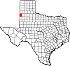 Bailey County, in the western Panhandle,
is bordered on the west by New Mexico, on the north by Parmer County,
on the east by Lamb County, and on the south by Cochran County. The
county center lies at 34°04' north latitude and 102°50' west longitude,
about seventy-five miles northwest of Lubbock. Bailey County is a part
of the Southern High Plains and has an altitude of 3,800 to 4,400 feet
above mean sea level. Its 835 square miles of plain are surfaced by
sandy loam covered with grasses and mesquite brush. The Double Mountain
Fork of the Brazos River drains the northern parts of the county; other
sections drain to numerous small playas. The most conspicuous
topographic feature is a range of sand hills that runs from northeast
to southwest a mile south of Muleshoe. The average annual rainfall is
17.29 inches. The average minimum temperature in January is 20° F; the
average maximum in July is 92° F. The growing season of 181 days is
shorter than the average for West Texas counties because of the higher
elevation and cooler weather. U.S. Highway 70/84 crosses the northeast
part of the county. State highways 214 and 298 carry traffic north to
south and east to west, respectively; in the early twenty-first
century the area was also served by the Burlington Northern Santa Fe
railroad.
Bailey County, in the western Panhandle,
is bordered on the west by New Mexico, on the north by Parmer County,
on the east by Lamb County, and on the south by Cochran County. The
county center lies at 34°04' north latitude and 102°50' west longitude,
about seventy-five miles northwest of Lubbock. Bailey County is a part
of the Southern High Plains and has an altitude of 3,800 to 4,400 feet
above mean sea level. Its 835 square miles of plain are surfaced by
sandy loam covered with grasses and mesquite brush. The Double Mountain
Fork of the Brazos River drains the northern parts of the county; other
sections drain to numerous small playas. The most conspicuous
topographic feature is a range of sand hills that runs from northeast
to southwest a mile south of Muleshoe. The average annual rainfall is
17.29 inches. The average minimum temperature in January is 20° F; the
average maximum in July is 92° F. The growing season of 181 days is
shorter than the average for West Texas counties because of the higher
elevation and cooler weather. U.S. Highway 70/84 crosses the northeast
part of the county. State highways 214 and 298 carry traffic north to
south and east to west, respectively; in the early twenty-first
century the area was also served by the Burlington Northern Santa Fe
railroad.
....Read More ....