Hays County
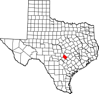
Hays County occupies an area of 693.5 square miles in south central Texas; the center of the county is at 98°00' west longitude and 30°00' north latitude, twenty-three miles southwest of Austin. The county is located on the border between the Edwards Plateau and the southern Black Prairie region. The Balcones Escarpment divides it into hilly, tree-covered ranch country in the northwest three-quarters and grassy, agricultural plains in the southeast quarter. The principal natural grasses are big bluestem and Indian grass; trees commonly associated with Central Texas-including live oak, cedar, pecan, and mesquite-are indigenous to Hays County. The elevation rises from east to west, varying from 600 to over 1,400 feet. The county's numerous streams generally flow in an easterly direction; the principal waterways are Bear, Cypress, and Onion creeks and the Blanco and San Marcos rivers. The Edwards Aquifer underlies the eastern area, where San Marcos Springs, the second largest in Texas, delivers about 160 cubic feet per second. The soil varies from thin limestone to black, waxy, chocolate, and grey loam. The mean annual rainfall is 33.75 inches. The average maximum temperature in July is 96° F; the average minimum temperature in January is 40°. Hays County has a growing season of 254 days.......
 |
In keeping with the policy of providing free information on the Internet, data may be used by non-commercial entities. These electronic pages may NOT be reproduced in any format for profit or for presentation by other persons or organizations. This site may NOT be linked to from a pay site. All data submitted to the Texas Trails To The Past remains copyright by the submitter. |  |
| Copyright 2014 - | All Rights Reserved |