Lubbock County
Texas Trails To The Past
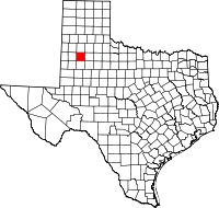 Lubbock
County is located in Northwest Texas on the Southern High Plains,
within the larger Great Plains of the western United States. The center
of the county lies at 33°35' north latitude and 101°52' west longitude.
Lubbock, its largest city, is 327 miles northwest of Dallas and 122
miles south of Amarillo. The county measures 893 square miles of flat
tableland sloping gently from northwest to southeast, with elevations
ranging from 2,900 to 3,400 feet. Its soils are mainly brown to
reddish-brown loams and sandy loams, with smaller areas of
grayish-brown, silty clay loams. These overlie a clay subsoil and,
beneath that, at from two to three feet from the surface, a hardpan of
caliche made of calcium carbonate. This caliche forms the Caprock,
which has generally prevented streams from cutting their way through
the area. Beneath the caliche zone lie beds of water-filled sand of
varying thickness but averaging about 300 feet; these make up a part of
the great Ogallala Aquifer, formed some ten million years ago as great
rivers deposited sand from the Rocky Mountains over an area extending
several hundred miles east of the mountains, from what is now Canada to
the South Plains of Texas. In 1968 there were 922 small, wind-scoured
lakes called playas
dotting the county and providing refuge for wildfowl.
Lubbock
County is located in Northwest Texas on the Southern High Plains,
within the larger Great Plains of the western United States. The center
of the county lies at 33°35' north latitude and 101°52' west longitude.
Lubbock, its largest city, is 327 miles northwest of Dallas and 122
miles south of Amarillo. The county measures 893 square miles of flat
tableland sloping gently from northwest to southeast, with elevations
ranging from 2,900 to 3,400 feet. Its soils are mainly brown to
reddish-brown loams and sandy loams, with smaller areas of
grayish-brown, silty clay loams. These overlie a clay subsoil and,
beneath that, at from two to three feet from the surface, a hardpan of
caliche made of calcium carbonate. This caliche forms the Caprock,
which has generally prevented streams from cutting their way through
the area. Beneath the caliche zone lie beds of water-filled sand of
varying thickness but averaging about 300 feet; these make up a part of
the great Ogallala Aquifer, formed some ten million years ago as great
rivers deposited sand from the Rocky Mountains over an area extending
several hundred miles east of the mountains, from what is now Canada to
the South Plains of Texas. In 1968 there were 922 small, wind-scoured
lakes called playas
dotting the county and providing refuge for wildfowl.
....Read More - Texas State Historical Association....
Read More Here